About us

The meaning of the word "Zenith"

In astronomy, zenith refers precisely to the highest point in the sky reached by the Sun or a celestial body relative to an observer on Earth. This point is directly above the observer’s head (samt al-ras). The word is widely used metaphorically in various languages ​​(including Persian) to refer to the peak of success, power, prosperity, or fame.

Introducing Zenith

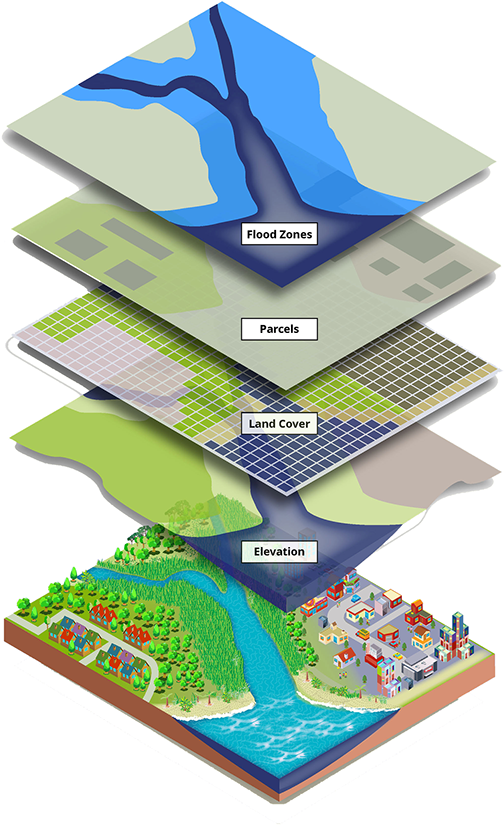
Zenith is a native and intelligent spatial services platform developed with the aim of simplifying spatial analytics (GIS) and applying geographic data in life, policymaking and business.

By combining three key components (native basemap, specialized layers and spatial analysis engine), this product provides a platform for users to transform spatial data into insights and then into decisions.

Outlook

Zenith will become the native and intelligent reference for spatial analytics; a tool that both ordinary people, businesses and organizations can benefit from for better decision-making in life, markets and policy-making.

In the development path, Zenith will become a spatial intelligence assistant (Spatial Copilot) using artificial intelligence and prompt analysis (Prompt-based GeoAI).

Mission

Create a native, user-friendly, and analytical platform for spatial data that:

  • provides a base map and specialized layers,
  • simplifies spatial analysis tools,
  • and paves the way for intelligent analytics powered by AI.

The ultimate goal: to transform GIS from a specialized tool to a general, usable skill for everyone.

Key stakeholders

Public users
Government organizations and institutions
Companies and startups
Universities, educational and research institutions and researchers
Investors and technology partners